|
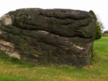
Ina's Rock Ina's Rock is a geological feature north of Alton village on the hillside over looking the Churnet Valley. It dates to the Triassic Period 250 to 245 million years ago. |
|
 |
Ipstones Edge The marked spot on the map is the Staffordshire Wildlife Trust Nature Reserve, Swineholes Wood Nature Reserve on Ipstones Edge. Many regard the road The Casey as 'Ipstones Edge', with its fine views across the Churnet Valley. On a clear day you can see The Wrekin in Shropshire, and the hills and mountains of Wales beyond. |
 |
Lion Boundary Marker, Dimmingsdale There are three of these around this point at Dimmingsdale. Clearly imposing boundary stones marked with a lion motif, I suppose by Earl of Shewsbury? |
|
Mill Farm Limekiln site A visible spoil heap and water-filled shaft. Adjoins a public right of way. |
|
|
|
Rainroach Rock Views across the Churnet Valley Rainroach Rock. |
 |
Rough Rock In the middle of one of the fairways there is a prominent block of Rough Rock showing large scale cross-bedding formed by a Namurian river. Which way do you think the river was flowing? Try to find contortions of the bedding due to water escape as the sediment compacted and solidified. The direction of the layers indicates that the Churnet once flowed in the opposite direction. More information on the geology and geomorphology of the area can be found in our Geotrail leaflets in the Walks section of the guide. |
 |
Side Farm Meadows Nature Reserve Side Farm Meadows Nature Reserve is managed by Staffordshire Wildlife Trust. There is a public footpath alongside and through it to enjoy the grassland that has escaped the type of agricultural activity that degrades it in wildlife terms. The Churnet Valley Living Landscape volunteers have been seed harvesting in these small fields undertake green hay strewing elsewhere: a technique used to distribute seeds to restore traditional grasslands in terms of the diversity of species. |
 |
Swineholes Wood Nature Reserve Swineholes Wood is a Staffordshire Wildlife Trust Nature Reserve and a designated SSSI by Natural England of 46ha. The site consists of three parcels of land in close proximity: Swineholes Wood, Black Heath and Casey Banks. It is considered an important heathland area in the Staffordshire Moorlands, with dwarf shrub heath, grassland and wetland features. Grid reference SK 050 501. Species of note include marsh violet, meadow pipit, cuckoo, heather, bog asphode. |
 |
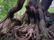
The Chained Oak The ‘chained oak’ is an old oak tree with heavy chains that is the subject of a popular legend. Allegedly a disgruntled beggarwoman put a curse upon the 15th Earl of Shrewsbury. She was loitering near the lodge gate to his home, Alton Abbey, and as the Earl passed by he shunned her pleas for money. Her revenge was to curse him: for every branch of the oak tree that falls, a member of his family would die. |
 |
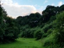
The Dale, Alton The Dale is a good example of a dry valley created during the last ice age 18000 years ago by seasonal snowmelt streams flowing over the frozen ground in front of the ice sheet. |